GIS Elevation Map / SRTM Data
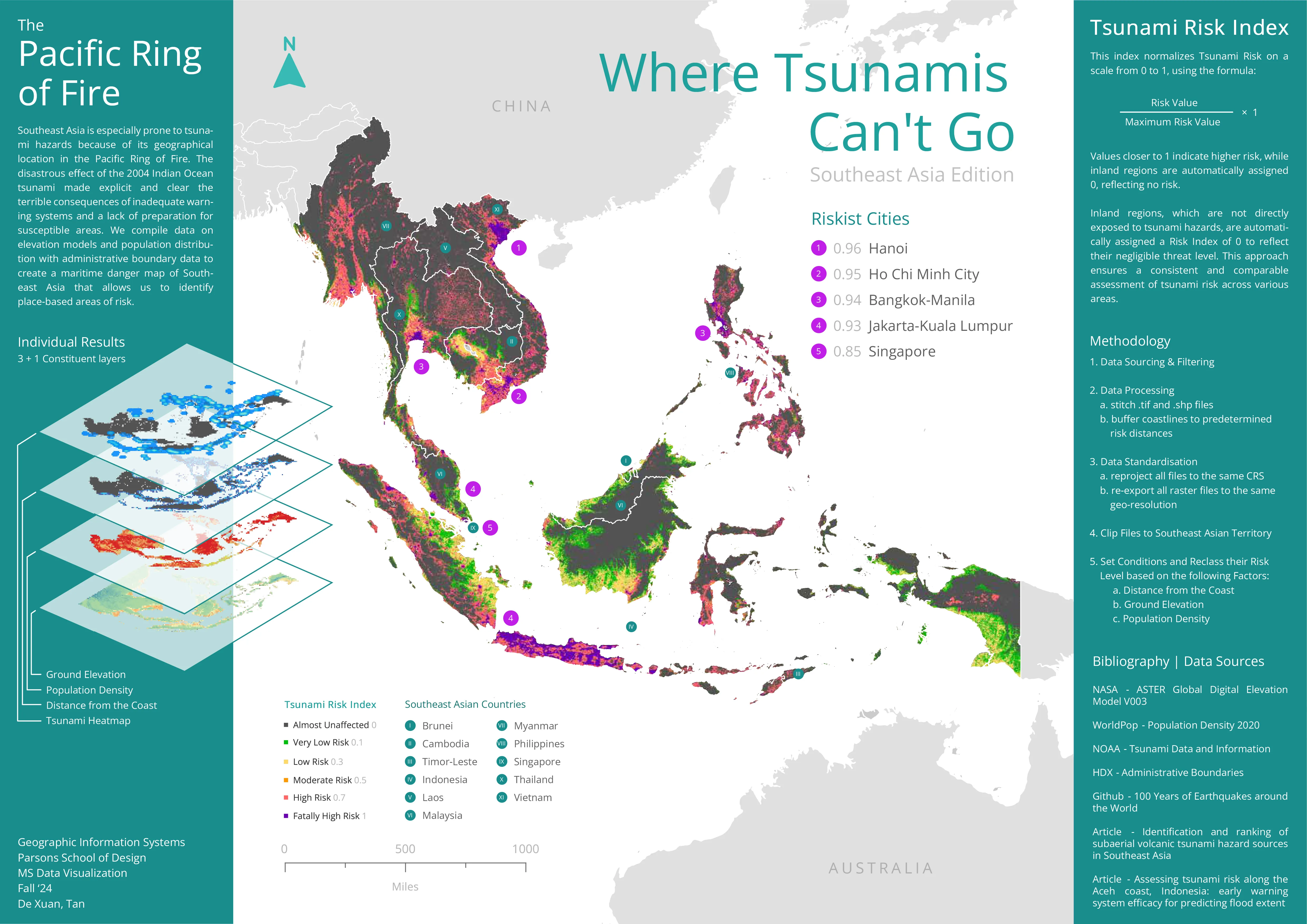
Where Tsunamis Can't Go
Year
2024
Category
Data Visualisation
Medium
GIS Elevation Map
Location
Bangkok, Thailand
A GIS-driven elevation analysis of Southeast Asia identifying terrain safe from tsunami inundation. Using SRTM elevation data layered over historical tsunami run-up records, the visualisation maps inland high-ground refuges across the region — finding out where is the safest place in Southeast Asia when the ocean turns against the land.